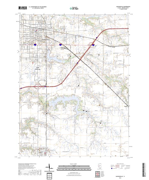
2024 Map of Jacksonville
USGS Topo · Published 2024About this map
Jacksonville serves as the regional hub of Morgan County, centered on the Morgan County Courthouse and the historic campus of Illinois College. This 2024 survey captures a landscape where established urban grids meet the sprawling water systems of Mauvaise Terre Lake and Lake Jacksonville. The drainage patterns of Mauvaise Terre Creek and Big Sandy Creek define the surrounding agricultural terrain, which is dotted with small outlying settlements like Arnold and Pisgah. For genealogists and local historians, the map is particularly detailed regarding burial sites, identifying numerous family and community grounds including Scott Cem, Asbury Cem, and Daniel Holmes Cem. The transition from the dense street plan of South Jacksonville to the more open reaches of Woodson illustrates the modern connectivity of this Illinois prairie region.
Find a feature on this map
134 named features on this map. Tap any name to fly to it.
Don’t see what you’re looking for? This feature index may not catch every label — zoom into the map to look around manually.
Map Details
Editions of this 2024 Jacksonville Map
This is the sole edition of this map. No revisions or reprints were ever made.
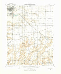
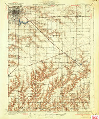
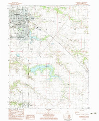
Historical Maps of Jacksonville Through Time
4 maps found