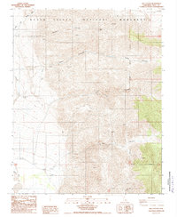
1988 Map of Jail Canyon
USGS Topo · Published 1988About this map
Death Valley National Monument dominates this 1988 topographic study, where deep canyons incise the steep slopes of the Panamint Range. Significant drainage features like Tuber Canyon, Jail Canyon, and Williams Canyon descend toward the valley floor, while Wildrose Canyon Wash and Wildrose Wash trace the western edge of the desert landscape.
Find a feature on this map
13 named features on this map. Tap any name to fly to it.
Don’t see what you’re looking for? This feature index may not catch every label — zoom into the map to look around manually.
Map Details
Editions of this 1988 Jail Canyon Map
2 editions found
Other maps of this area

1908 · Ballarat
USGS Topo · 1:250,000

1913 · Ballarat
USGS Topo · 1:250,000

1948 · Death Valley
USGS Topo · 1:250,000

1951 · Panamint Butte
USGS Topo · 1:62,500

1951 · Maturango Peak
USGS Topo · 1:62,500

1952 · Telescope Peak
USGS Topo · 1:62,500

1952 · Emigrant Canyon
USGS Topo · 1:62,500

1954 · Death Valley
USGS Topo · 1:250,000

1956 · Death Valley
USGS Topo · 1:250,000

1957 · Death Valley
USGS Topo · 1:250,000