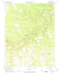
1968 Map of Jam Up Cave
USGS Topo · Published 1975About this map
The Jacks Fork river carves a winding path through Shannon County in this late 1960s study, a period when the newly authorized Ozark National Scenic Riverways was beginning to preserve the area's subterranean and riparian landmarks. The landscape is defined by its karst topography, featuring numerous named caverns like Jam Up Cave, Meeting House Cave, and Peter Renfro Cave. These geological formations, alongside substantial springs such as Rymer Spring and Bunker Hill Spring, illustrate the complex hydrology of the Missouri Ozarks.
Find a feature on this map
46 named features on this map. Tap any name to fly to it.
Don’t see what you’re looking for? This feature index may not catch every label — zoom into the map to look around manually.
Map Details
Editions of this 1968 Jam Up Cave Map
4 editions found
Other maps of this area

1915 · Eminence
USGS Topo · 1:62,500

1917 · Eminence
USGS Topo · 1:62,500

1931 · Bandyville
USGS Topo · 1:48,000

1944 · Birch Tree
USGS Topo · 1:62,500

1945 · Montier
USGS Topo · 1:62,500

1946 · Summersville
USGS Topo · 1:62,500

1948 · Montier
USGS Topo · 1:62,500

1948 · Birch Tree
USGS Topo · 1:62,500

1948 · Summersville
USGS Topo · 1:62,500

1949 · Rolla
USGS Topo · 1:250,000