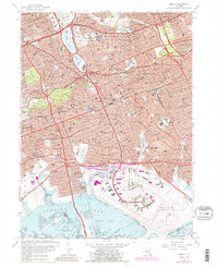
1966 Map of Jamaica
USGS Topo · Published 1988About this map
Jamaica Bay and its intricate network of marshes, such as Elders Point Marsh and Duck Point Marshes, dominate the southern reach of this mid-century Queens landscape. The map captures the massive footprint of John F Kennedy International Airport alongside the industrial and residential corridors of Jamaica and Richmond Hill. This period of urban density is characterized by a dense grid of parochial schools and cemeteries, including St Johns Cemetery and Mount St Marys Cemetery, serving the established neighborhoods of Corona and Ozone Park.
Find a feature on this map
107 named features on this map. Tap any name to fly to it.
Don’t see what you’re looking for? This feature index may not catch every label — zoom into the map to look around manually.
Map Details
Editions of this 1966 Jamaica Map
2 editions found
Other maps of this area

1889 · Brooklyn
USGS Topo · 1:62,500

1891 · Brooklyn
USGS Topo · 1:62,500

1891 · Harlem
USGS Topo · 1:62,500

1897 · Harlem
USGS Topo · 1:62,500

1897 · Brooklyn
USGS Topo · 1:62,500

1897 · Hempstead
USGS Topo · 1:62,500

1897 · Oyster Bay
USGS Topo · 1:62,500

1898 · Harlem
USGS Topo · 1:62,500

1898 · Hempstead
USGS Topo · 1:62,500

1898 · Brooklyn
USGS Topo · 1:62,500