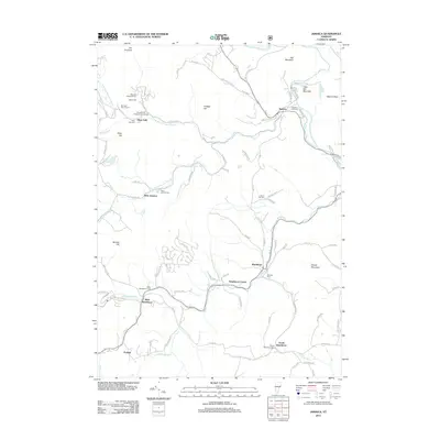
2012 Map of Jamaica
USGS Topo · Published 2012About this map
Jamaica State Park and the surrounding river valleys of Windham County define this landscape along the W River. The 2012 topography shows a decentralized network of historic villages including Jamaica, Wardsboro, Wardsboro Center, West Wardsboro, and South Wardsboro. These settlements are linked by winding routes like W Jamaica Rd and Pikes Falls Rd, following the natural contours of the Green Mountains.
Find a feature on this map
108 named features on this map. Tap any name to fly to it.
Don’t see what you’re looking for? This feature index may not catch every label — zoom into the map to look around manually.
Map Details
Editions of this 2012 Jamaica Map
This is the sole edition of this map. No revisions or reprints were ever made.
Other maps of this area

1889 · Wilmington
USGS Topo · 1:62,500

1891 · Wilmington
USGS Topo · 1:62,500

1891 · Brattleboro
USGS Topo · 1:62,500

1893 · Brattleboro
USGS Topo · 1:62,500

1894 · Londonderry
USGS Topo · 1:62,500

1899 · Londonderry
USGS Topo · 1:62,500

1899 · Wilmington
USGS Topo · 1:62,500

1930 · Saxtons River
USGS Topo · 1:48,000

1932 · Brattleboro
USGS Topo · 1:48,000

1933 · Saxtons River
USGS Topo · 1:62,500