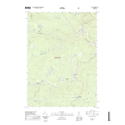
2021 Map of Jamaica
USGS Topo · Published 2021About this map
Jamaica serves as a primary hub within this 2021 landscape, situated along the West River near the notable Salmon Hole. The geography of the region is defined by a series of small, dispersed settlements including Wardsboro, Wardsboro Center, and West Wardsboro, each maintaining its own distinct character in the shadow of Stacey Mtn. The proliferation of family and local cemeteries, such as Wilder Cem, Mundell-Bourne Cem, and Robinson Dalewood Cem, offers significant genealogical value, anchoring the modern landscape in generations of residency.
Find a feature on this map
110 named features on this map. Tap any name to fly to it.
Don’t see what you’re looking for? This feature index may not catch every label — zoom into the map to look around manually.
Map Details
Editions of this 2021 Jamaica Map
This is the sole edition of this map. No revisions or reprints were ever made.
Other maps of this area

1889 · Wilmington
USGS Topo · 1:62,500

1891 · Wilmington
USGS Topo · 1:62,500

1891 · Brattleboro
USGS Topo · 1:62,500

1893 · Brattleboro
USGS Topo · 1:62,500

1894 · Londonderry
USGS Topo · 1:62,500

1899 · Londonderry
USGS Topo · 1:62,500

1899 · Wilmington
USGS Topo · 1:62,500

1930 · Saxtons River
USGS Topo · 1:48,000

1932 · Brattleboro
USGS Topo · 1:48,000

1933 · Saxtons River
USGS Topo · 1:62,500