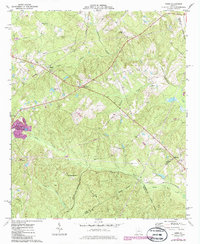
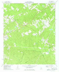
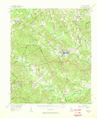
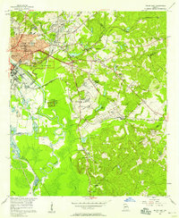
1973 Map of James
USGS Topo · Published 1985About this map
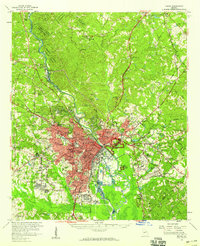
Greenberry Crossroads and the surrounding woodlands of central Georgia are captured here during a period of transition in the early 1970s. The landscape is defined by the convergence of major transportation corridors, specifically where the Seaboard Coast Line railroad intersects with local rural life near James. Further south, the Central of Georgia railroad tracks pass through Lewiston, underscoring the vital role rail infrastructure played in connecting these rural outposts. A significant Quarry and various Wells suggest the industrial and resource-based activities of the era.
Find a feature on this map
30 named features on this map. Tap any name to fly to it.
Don’t see what you’re looking for? This feature index may not catch every label — zoom into the map to look around manually.
Map Details
Editions of this 1973 James Map
2 editions found
Other maps of this area

1953 · Athens
USGS Topo · 1:250,000
1956 · Gordon
USGS Topo · 1:62,500
1956 · Macon East
USGS Topo · 1:24,000
1956 · Macon
USGS Topo · 1:62,500

1957 · Macon
USGS Topo · 1:250,000

1958 · Macon
USGS Topo · 1:250,000

1958 · Athens
USGS Topo · 1:250,000

1959 · Athens
USGS Topo · 1:250,000

1963 · Athens
USGS Topo · 1:250,000

1964 · Macon
USGS Topo · 1:250,000