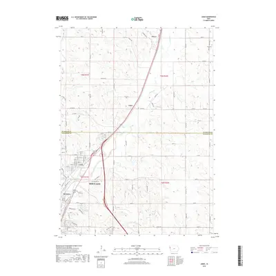
2018 Map of James
USGS Topo · Published 2018About this map
Sioux City expands northward along the winding course of the Floyd River in this detailed 2018 study of the Iowa landscape. The map highlights the transition from the dense urban neighborhoods of Leeds and Springdale into the rural townships of Plymouth and Woodbury counties. The drainage of Little Whisky Cr and the recreational path of the Bacon Creek Trail define the eastern periphery of the city's reach. Further north, the smaller settlements of James and Hinton sit along the primary transport corridor that follows the river valley, surrounded by a systematic grid of section roads such as 300th St and Co Rd C70. This map captures a modern view of regional connectivity, where legacy landmarks like the Hungerford Cem remain as points of historical continuity amidst the evolving suburban and agricultural interface.
Find a feature on this map
52 named features on this map. Tap any name to fly to it.
Don’t see what you’re looking for? This feature index may not catch every label — zoom into the map to look around manually.
Map Details
Editions of this 2018 James Map
This is the sole edition of this map. No revisions or reprints were ever made.
Other maps of this area

1955 · Sioux City
USGS Topo · 1:250,000

1958 · Sioux City
USGS Topo · 1:250,000

1959 · Sioux City
USGS Topo · 1:250,000

1962 · Union Center
USGS Topo · 1:62,500

1963 · Sioux City South
USGS Topo · 1:24,000

1963 · Sioux City North
USGS Topo · 1:24,000

1964 · Sergeant Bluff
USGS Topo · 1:24,000

1964 · James
USGS Topo · 1:24,000

1964 · Hinton
USGS Topo · 1:24,000

1964 · Lawton
USGS Topo · 1:24,000