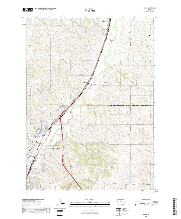
2022 Map of James
USGS Topo · Published 2022About this map
The Floyd River valley forms the central corridor of this survey, where the small community of James serves as a point of transition between the northern agricultural reaches and the expanding urban edges of Sioux City. The map documents the specific boundary where Plymouth Co meets Woodbury Co, illustrating how the township grid and rural roads like Lone Tree Rd and Glacier RD interact with the natural drainage of Little Whisky Cr. To the south, the established neighborhoods of Leeds and Springdale show the residential development following the river's path, while the northern edge is anchored by the town of Hinton. Local genealogy is anchored by the presence of Hungerford Cem in the northeast, a surviving landmark in an area otherwise dominated by the systematic expansion of the county road network.
Find a feature on this map
94 named features on this map. Tap any name to fly to it.
Don’t see what you’re looking for? This feature index may not catch every label — zoom into the map to look around manually.
Map Details
Editions of this 2022 James Map
This is the sole edition of this map. No revisions or reprints were ever made.
Other maps of this area

1955 · Sioux City
USGS Topo · 1:250,000

1958 · Sioux City
USGS Topo · 1:250,000

1959 · Sioux City
USGS Topo · 1:250,000

1962 · Union Center
USGS Topo · 1:62,500

1963 · Sioux City South
USGS Topo · 1:24,000

1963 · Sioux City North
USGS Topo · 1:24,000

1964 · Sergeant Bluff
USGS Topo · 1:24,000

1964 · James
USGS Topo · 1:24,000

1964 · Hinton
USGS Topo · 1:24,000

1964 · Lawton
USGS Topo · 1:24,000