
1943 Map of Jamestown
USGS Topo · Published 1962About this map
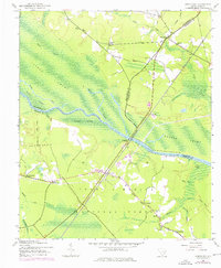
The Santee River carves through the heart of this Lowcountry landscape, separating the dense wetlands of the Santee Swamp from the managed lands of the Francis Marion National Forest. During this mid-century period, the Seaboard Air Line railroad served as the primary industrial spine of the region, connecting small settlements like Dorien Sta and Jamestown to broader markets. The map reveals a transition in river transit, marking the location of Lanes Ferry (Abandoned), which once provided a vital link between Berkeley and Williamsburg counties before modern infrastructure superseded it.
Find a feature on this map
32 named features on this map. Tap any name to fly to it.
Don’t see what you’re looking for? This feature index may not catch every label — zoom into the map to look around manually.
Map Details
Editions of this 1943 Jamestown Map
2 editions found
Other maps of this area

1919 · Cordesville
USGS Topo · 1:48,000

1942 · Cedar Creek
USGS Topo · 1:24,000

1942 · Honey Hill
USGS Topo · 1:24,000

1943 · Shulerville
USGS Topo · 1:24,000

1943 · Trio
USGS Topo · 1:24,000

1943 · Andrews
USGS Topo · 1:24,000

1943 · Bonneau
USGS Topo · 1:62,500

1948 · Bethera
USGS Topo · 1:24,000

1949 · Georgetown
USGS Topo · 1:250,000
1950 · Bethera
USGS Topo · 1:24,000