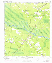
1943 Map of Jamestown
USGS Topo · Published 1976About this map
The Santee River snakes through a complex drainage of swamps and islands, defining the rural landscape between Berkeley, Georgetown, and Williamsburg Counties. During the early 1940s, this area remained largely dominated by the Francis Marion National Forest and the vast Santee Swamp. Small, scattered communities like Jamestown, Palmerville, and Washington are connected by the Seaboard Coast Line railroad, which bisects the quadrangle. Local heritage is deeply rooted in the landscape, evidenced by rural religious centers like Zion Ch and St Marys Ch. One of the most significant historical markers is Leneuds Ferry (Abandoned), indicating a once-vital river crossing that had fallen out of use by the time of the 1943 survey. The topography is defined by slow-moving water systems, including Wittee Lake and Dutart Creek, which shaped the early patterns of settlement and transport in this Lowcountry region.
Find a feature on this map
33 named features on this map. Tap any name to fly to it.
Don’t see what you’re looking for? This feature index may not catch every label — zoom into the map to look around manually.
Map Details
Editions of this 1943 Jamestown Map
2 editions found
Other maps of this area

1919 · Cordesville
USGS Topo · 1:48,000

1942 · Cedar Creek
USGS Topo · 1:24,000

1942 · Honey Hill
USGS Topo · 1:24,000

1943 · Shulerville
USGS Topo · 1:24,000

1943 · Trio
USGS Topo · 1:24,000

1943 · Andrews
USGS Topo · 1:24,000

1943 · Jamestown
USGS Topo · 1:24,000

1943 · Bonneau
USGS Topo · 1:62,500

1948 · Bethera
USGS Topo · 1:24,000

1949 · Georgetown
USGS Topo · 1:250,000