
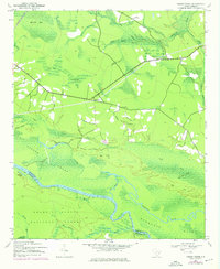
1942 Map of Cedar Creek
USGS Topo · Published 1962About this map
Santee River and the vast wetlands of the Francis Marion National Forest dominate this 1942 landscape on the border of Georgetown and Berkeley counties. The map captures a primarily rural and swampy terrain, defined by the winding course of Wadmacon Creek and the low-lying Wadmacon Island. Small settlements like Lambert are sparsely distributed, often situated near the Seaboard Air Line railroad which cuts diagonally across the northern woods. Lowland features such as Mackey Bay and Bino Bay are interspersed with subtle rises like Big Hill and Jack Hill. Along the riverbanks, locations such as Price Landing suggest historical points of water access and local river-based activity. The presence of Trinity Ch and the secluded Denis Lodge provides specific points of interest for genealogists and local historians tracing the mid-century development of this South Carolina coastal plain.
Find a feature on this map
32 named features on this map. Tap any name to fly to it.
Don’t see what you’re looking for? This feature index may not catch every label — zoom into the map to look around manually.
Map Details
Editions of this 1942 Cedar Creek Map
2 editions found
Other maps of this area

1942 · Honey Hill
USGS Topo · 1:24,000

1943 · Olin
USGS Topo · 1:31,680

1943 · Shulerville
USGS Topo · 1:24,000

1943 · Trio
USGS Topo · 1:24,000

1943 · Kilsock Bay
USGS Topo · 1:24,000

1943 · Andrews
USGS Topo · 1:24,000

1943 · Jamestown
USGS Topo · 1:24,000

1943 · Santee
USGS Topo · 1:24,000

1949 · Georgetown
USGS Topo · 1:250,000

1967 · Georgetown
USGS Topo · 1:250,000