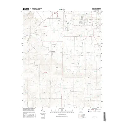
2017 Map of Jamestown
USGS Topo · Published 2017About this map
Jamestown and Locust Grove serve as key landmarks in this portion of Independence County, where the terrain transitions from the lowlands near the White River into the rising hills of the Ozark foothills. The landscape is defined by its drainages, including the prominent Greenbrier Creek and Buffalo Cr, which carve through the topography alongside numerous family-named hollows like Tivis Flynn Hollow and Ed Taylor Hollow. In the north, the Batesville Regional Airport represents modern infrastructure amidst long-standing rural settlements like Desha, Southside, and McHue. This 2017 survey provides a detailed view of local genealogy through numerous burial sites, including Palestine Cem, Locust Grove Cem, and Alderbrook Cem. The map captures the continued significance of high ground such as Jamestown Mtn, Strother Mtn, and Hutchinson Mtn, which have likely shaped local transport and settlement patterns for generations.
Find a feature on this map
135 named features on this map. Tap any name to fly to it.
Don’t see what you’re looking for? This feature index may not catch every label — zoom into the map to look around manually.
Map Details
Editions of this 2017 Jamestown Map
This is the sole edition of this map. No revisions or reprints were ever made.
Other maps of this area

1890 · Batesville
USGS Topo · 1:125,000

1891 · Batesville
USGS Topo · 1:125,000

1942 · Bethesda
USGS Topo · 1:24,000

1942 · Jamestown
USGS Topo · 1:31,680

1942 · Almond
USGS Topo · 1:31,680

1942 · Salado
USGS Topo · 1:31,680

1942 · Batesville
USGS Topo · 1:31,680

1943 · Sulphur Rock
USGS Topo · 1:31,680

1943 · Batesville
USGS Topo · 1:24,000

1953 · Memphis
USGS Topo · 1:250,000