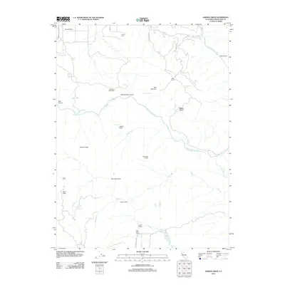
2012 Map of Jamison Ridge
USGS Topo · Published 2012About this map
Round Valley and the surrounding high country of Mendocino County define this 2012 survey, where the Middle Fork Eel River carves a deep path through the landscape. This area is characterized by isolated homesteads and ranching history, evidenced by Thrash Ranch, Marks Place, and the extensive Eden Valley Ranch to the south. Local heritage is rooted in the early settlement of the region, anchored by the Pioneer Cem near the northern edge of the map. High ridges and distinctive peaks, such as Jarbow Ridge, Jamison Ridge, and Negro Head, dominate the topography between the drainages of Eden Cr and Salt Cr. The presence of several remote water sources like Redwine Spring and Jarbow Spring points to the vital importance of water management in this high-elevation terrain.
Find a feature on this map
39 named features on this map. Tap any name to fly to it.
Don’t see what you’re looking for? This feature index may not catch every label — zoom into the map to look around manually.
Map Details
Editions of this 2012 Jamison Ridge Map
This is the sole edition of this map. No revisions or reprints were ever made.
Other maps of this area

1920 · Covelo
USGS Topo · 1:62,500

1926 · Covelo
USGS Topo · 1:62,500

1929 · Eden Valley
USGS Topo · 1:62,500

1951 · Laytonville
USGS Topo · 1:62,500

1952 · Spyrock
USGS Topo · 1:62,500

1952 · Eden Valley
USGS Topo · 1:62,500

1952 · Covelo
USGS Topo · 1:62,500

1957 · Ukiah
USGS Topo · 1:250,000

1960 · Ukiah
USGS Topo · 1:250,000
1966 · Sanhedrin Mtn
USGS Topo · 1:24,000