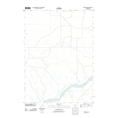
2011 Map of Jamison SW
USGS Topo · Published 2011About this map
Dyer anchors the western edge of this Nebraska landscape, where the northern high plains meet the winding corridor of the Niobrara River. This survey captures the rural topography of Keya Paha County, characterized by a complex network of drainage systems feeding into the river. The hydrologic patterns are particularly distinct here, with Anne Creek carving a significant path across the central terrain, supported by the localized Big Anne Spring. Other smaller watercourses, including Rock Creek, Coon Creek, and Willow Creek, illustrate the natural drainage that defines this ranching country. The map provides a clear look at the sparse road network and scattered homestead sites typical of the region's late-twentieth-century development, preserving the exact layout of land use before the further consolidation of local agriculture.
Find a feature on this map
7 named features on this map. Tap any name to fly to it.
Don’t see what you’re looking for? This feature index may not catch every label — zoom into the map to look around manually.
Map Details
Editions of this 2011 Jamison SW Map
This is the sole edition of this map. No revisions or reprints were ever made.
Other maps of this area

1949 · Jamison SW
USGS Topo · 1:24,000

1949 · Riverview
USGS Topo · 1:24,000

1949 · Carns
USGS Topo · 1:24,000

1950 · Carns
USGS Topo · 1:24,000

1950 · Riverview
USGS Topo · 1:24,000

1950 · Mariaville
USGS Topo · 1:24,000

1951 · Jamison SW
USGS Topo · 1:24,000

1954 · Newport NE
USGS Topo · 1:24,000

1955 · O'Neill
USGS Topo · 1:250,000

1959 · O'Neill
USGS Topo · 1:250,000