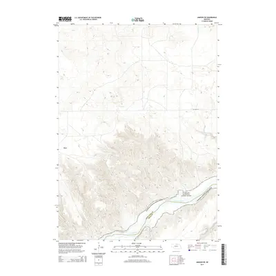
2014 Map of Jamison SW
USGS Topo · Published 2014About this map
Dyer anchors the western edge of this landscape where the Nebraska sandhills transition toward the river breaks of the northern border. This area is defined by the deeply carved valley of the Niobrara River, which is designated here as the Niobrara National Scenic River. The topography shifts from the level uplands near Hay Valley Rd to the intricate network of canyons and bluffs feeding into the river. Water sources like Big Anne Spring and tributaries including Anne Cr, Rock Cr, and Coon Cr provide the primary drainage for the surrounding cattle country. The map also delineates the boundary between Keya Paha Co and Rock Co as it follows the path of the river, illustrating the natural border that has long shaped the political and social geography of this ranching region.
Find a feature on this map
10 named features on this map. Tap any name to fly to it.
Don’t see what you’re looking for? This feature index may not catch every label — zoom into the map to look around manually.
Map Details
Editions of this 2014 Jamison SW Map
This is the sole edition of this map. No revisions or reprints were ever made.
Other maps of this area

1949 · Jamison SW
USGS Topo · 1:24,000

1949 · Riverview
USGS Topo · 1:24,000

1949 · Carns
USGS Topo · 1:24,000

1950 · Carns
USGS Topo · 1:24,000

1950 · Riverview
USGS Topo · 1:24,000

1950 · Mariaville
USGS Topo · 1:24,000

1951 · Jamison SW
USGS Topo · 1:24,000

1954 · Newport NE
USGS Topo · 1:24,000

1955 · O'Neill
USGS Topo · 1:250,000

1959 · O'Neill
USGS Topo · 1:250,000