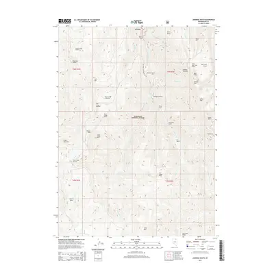
2015 Map of Jarbidge South
USGS Topo · Published 2015About this map
Jarbidge sits at the northern edge of this high-altitude landscape, where the Jarbidge River carves through deep canyons and gulches within the Humboldt National Forest. This region is defined by its dramatic verticality, spanning from the Copper Basin in the southwest to the towering Jarbidge Mountains in the northeast. The geography reveals a complex network of volcanic and tectonic features, most notably the Little Jack Creek Crater and Jack Creek Crater situated near Bald Peak. Numerous named peaks like the Matterhorn and Jumbo Peak punctuating the skyline indicate the area's significance for early prospecting and mountain navigation. Water sources are abundant but seasonal, with drainage systems like Dead Horse Cr and Seventysix Cr feeding into the larger river systems that shaped the settlement patterns of northern Elko County.
Find a feature on this map
54 named features on this map. Tap any name to fly to it.
Don’t see what you’re looking for? This feature index may not catch every label — zoom into the map to look around manually.
Map Details
Editions of this 2015 Jarbidge South Map
This is the sole edition of this map. No revisions or reprints were ever made.
Other maps of this area

1935 · Charleston
USGS Topo · 1:48,000

1936 · Rowland
USGS Topo · 1:48,000

1940 · Rowland
USGS Topo · 1:62,500

1942 · Mt. Velma
USGS Topo · 1:62,500

1943 · Jarbidge
USGS Topo · 1:62,500

1945 · Jarbidge
USGS Topo · 1:62,500

1955 · Wells
USGS Topo · 1:250,000

1958 · Wells
USGS Topo · 1:250,000

1961 · Wells
USGS Topo · 1:250,000

1968 · Marys River Basin NE
USGS Topo · 1:24,000