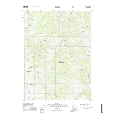
2018 Map of Jarbidge South
USGS Topo · Published 2018About this map
The settlement of Jarbidge sits at the northern edge of this high-elevation landscape, where the Jarbidge River carves through deep canyons and gulches. Dominating the eastern half are the Jarbidge Mountains, featuring prominent summits such as Jarbidge Peak, Bald Peak, and the distinctive Matterhorn. This 2018 survey within the Humboldt National Forest reveals an extensive network of pack trails and forest access roads, including the Jarbidge River Trail and the Altitude Trail, which traverse the high divides between the Copper Mountains and the Fox Creek Range. In the western portion, the landscape transitions through Bear Creek Meadows toward the Copper Basin, a region defined by steep drainages like Coon Creek and Telephone Canyon. Unique geological features are also present, most notably the Jack Creek Crater and the Little Jack Creek Crater near the northern boundary.
Find a feature on this map
70 named features on this map. Tap any name to fly to it.
Don’t see what you’re looking for? This feature index may not catch every label — zoom into the map to look around manually.
Map Details
Editions of this 2018 Jarbidge South Map
This is the sole edition of this map. No revisions or reprints were ever made.
Other maps of this area

1935 · Charleston
USGS Topo · 1:48,000

1936 · Rowland
USGS Topo · 1:48,000

1940 · Rowland
USGS Topo · 1:62,500

1942 · Mt. Velma
USGS Topo · 1:62,500

1943 · Jarbidge
USGS Topo · 1:62,500

1945 · Jarbidge
USGS Topo · 1:62,500

1955 · Wells
USGS Topo · 1:250,000

1958 · Wells
USGS Topo · 1:250,000

1961 · Wells
USGS Topo · 1:250,000

1968 · Marys River Basin NE
USGS Topo · 1:24,000