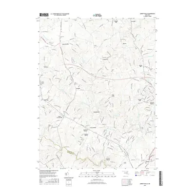
2016 Map of Jarrettsville
USGS Topo · Published 2016About this map
Jarrettsville and Fallston anchor this landscape in northern Maryland, where the drainage systems of Winters Run and the Little Gunpowder Falls carve through the countryside. The map reveals a dense network of local history, marked by numerous small burial grounds and landmarks like the Old Brick Cem and Highview Memorial Gardens. Modern utility and legacy meet at the Bel Air Reservoir and the residential clusters of Forest Hill and Forest Lake. The terrain is defined by its waterways, from the Bread and Cheese Br to the winding path of Bynum Run near the Harford and Baltimore County line. This 2016 survey documents the enduring community structures of the region, including smaller hamlets like Upper Crossroads, Chrome Hill, and Benson, illustrating the transition from open agricultural land to contemporary suburban development.
Find a feature on this map
228 named features on this map. Tap any name to fly to it.
Don’t see what you’re looking for? This feature index may not catch every label — zoom into the map to look around manually.
Map Details
Editions of this 2016 Jarrettsville Map
This is the sole edition of this map. No revisions or reprints were ever made.
Other maps of this area

1893 · Gunpowder
USGS Topo · 1:62,500

1894 · Baltimore
USGS Topo · 1:62,500

1898 · Tolchester
USGS Topo · 1:125,000

1899 · Baltimore
USGS Topo · 1:62,500

1900 · Parkton
USGS Topo · 1:62,500

1901 · Belair
USGS Topo · 1:62,500

1901 · Gunpowder
USGS Topo · 1:62,500

1902 · Parkton
USGS Topo · 1:62,500

1903 · Tolchester
USGS Topo · 1:125,000

1904 · Baltimore
USGS Topo · 1:62,500