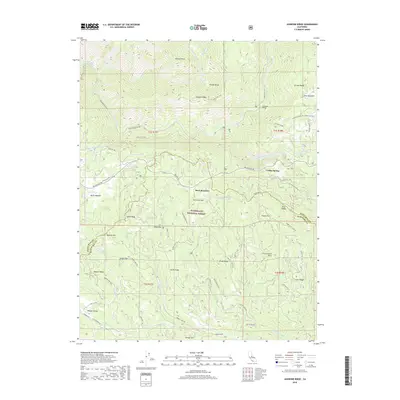
2018 Map of Jawbone Ridge
USGS Topo · Published 2018About this map
Jawbone Ridge dominates the northern landscape of this region within the Stanislaus National Forest, where the topography drops sharply into the Tuolumne Canyon. The Tuolumne River and its major tributaries, including the Clavey River and the Middle Tuolumne River, carve deep paths through the high country. Near the center of the map, the settlement of Buck Meadows serves as a key junction along Big Oak Flat Rd, while the Hetch Hetchy Aqueduct cuts across the western slopes, a critical piece of California's water infrastructure. To the south, the terrain descends toward the N Fork Merced River, passing through high-altitude meadows like Drew Meadow and Burch Meadow. Genealogists and local historians can trace named landmarks such as Frank Harris Point and Hobron Hill, alongside several high flats like Pigeon Flat and China Flat.
Find a feature on this map
76 named features on this map. Tap any name to fly to it.
Don’t see what you’re looking for? This feature index may not catch every label — zoom into the map to look around manually.
Map Details
Editions of this 2018 Jawbone Ridge Map
This is the sole edition of this map. No revisions or reprints were ever made.
Other maps of this area

1893 · Sonora
USGS Topo · 1:125,000

1896 · Sonora
USGS Topo · 1:125,000

1897 · Sonora
USGS Topo · 1:125,000

1897 · Yosemite
USGS Topo · 1:125,000

1898 · Sonora
USGS Topo · 1:125,000

1900 · Yosemite
USGS Topo · 1:125,000

1903 · Yosemite
USGS Topo · 1:125,000

1909 · Yosemite
USGS Topo · 1:125,000

1947 · San Jose
USGS Topo · 1:250,000

1947 · Mariposa
USGS Topo · 1:250,000