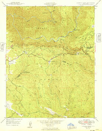
1949 Map of Jawbone Ridge
USGS Topo · Published 1949About this map
Stanislaus National Forest serves as the backdrop for this mid-century look at the high-elevation terrain between the Tuolumne River and the North Fork Merced River. The landscape is defined by the intersection of early mining efforts and burgeoning infrastructure, exemplified by the Gold Queen Mine (Abandoned) and the Argo Mine contrasted against the monumental engineering of the Hetch Hetchy Aqueduct and Hetch Hetchy Road.
Find a feature on this map
49 named features on this map. Tap any name to fly to it.
Don’t see what you’re looking for? This feature index may not catch every label — zoom into the map to look around manually.
Map Details
Editions of this 1949 Jawbone Ridge Map
This is the sole edition of this map. No revisions or reprints were ever made.
Other maps of this area

1893 · Sonora
USGS Topo · 1:125,000

1896 · Sonora
USGS Topo · 1:125,000

1897 · Sonora
USGS Topo · 1:125,000

1897 · Yosemite
USGS Topo · 1:125,000

1898 · Sonora
USGS Topo · 1:125,000

1900 · Yosemite
USGS Topo · 1:125,000

1903 · Yosemite
USGS Topo · 1:125,000

1909 · Yosemite
USGS Topo · 1:125,000

1947 · San Jose
USGS Topo · 1:250,000

1947 · Mariposa
USGS Topo · 1:250,000