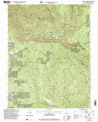
2001 Map of Jawbone Ridge
USGS Topo · Published 2004About this map
The Tuolumne Wild and Scenic River and its rugged tributaries dominate this portion of the Stanislaus National Forest at the start of the 21st century. The landscape is defined by steep elevation changes, from the depths of Hunter Bend and Lumsden Bridge up to the high peaks of Jawbone Ridge and Graveyard Ridge. Evidence of mid-century forest management and earlier resource extraction is clear through the presence of the Groveland Ranger Station, Smith Peak Lookout, and the Argo Mine located near Shingle Hill.
Find a feature on this map
44 named features on this map. Tap any name to fly to it.
Don’t see what you’re looking for? This feature index may not catch every label — zoom into the map to look around manually.
Map Details
Editions of this 2001 Jawbone Ridge Map
This is the sole edition of this map. No revisions or reprints were ever made.
Other maps of this area

1893 · Sonora
USGS Topo · 1:125,000

1896 · Sonora
USGS Topo · 1:125,000

1897 · Sonora
USGS Topo · 1:125,000

1897 · Yosemite
USGS Topo · 1:125,000

1898 · Sonora
USGS Topo · 1:125,000

1900 · Yosemite
USGS Topo · 1:125,000

1903 · Yosemite
USGS Topo · 1:125,000

1909 · Yosemite
USGS Topo · 1:125,000

1947 · San Jose
USGS Topo · 1:250,000

1947 · Mariposa
USGS Topo · 1:250,000