
1974 Map of Jay Em
USGS Topo · Published 1978About this map
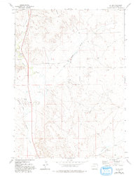
Jay Em stands as the primary settlement in this corner of Goshen County, situated along the banks of Rawhide Creek. The landscape is defined by its drainage systems, including Muskrat Creek and the meandering Red Cloud Slough, which characterize the high plains topography. A notable historical transport corridor, the Ft Laramie Road, traverses the western portion of the map, tracing a legacy of western expansion and local commerce through the prairie. Further south, the Sixmile Creek Ranch and Sixmile Creek anchor the rural landscape, while a prominent north-south pipeline and various scattered wells reflect the mid-century infrastructure supporting the region's ranching and industrial activity. The map provides a detailed view of the sectional divisions between T 29 N and T 28 N, marking the transition across this high-plains terrain in the mid-1970s.
Find a feature on this map
11 named features on this map. Tap any name to fly to it.
Don’t see what you’re looking for? This feature index may not catch every label — zoom into the map to look around manually.
Map Details
Editions of this 1974 Jay Em Map
2 editions found
Other maps of this area

1896 · Patrick
USGS Topo · 1:125,000

1954 · Torrington
USGS Topo · 1:250,000

1958 · Torrington
USGS Topo · 1:250,000

1974 · Spoon Butte SW
USGS Topo · 1:24,000
1974 · Jay Em NW
USGS Topo · 1:24,000

1974 · Rawhide Buttes East
USGS Topo · 1:24,000
1977 · Red Cloud Creek West
USGS Topo · 1:24,000

1977 · Hileman Draw
USGS Topo · 1:24,000

1977 · Prairie Center
USGS Topo · 1:24,000
1977 · Red Cloud Creek East
USGS Topo · 1:24,000