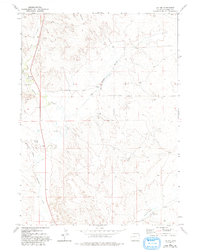
1974 Map of Jay Em
USGS Topo · Published 1993About this map
Jay Em serves as the primary focal point in this portion of Goshen County, situated along the banks of Rawhide Creek. The landscape is defined by its drainage network, where Muskrat Creek and Lowry Draw feed into the larger creek system, illustrating the water-dependent settlement patterns of the Wyoming high plains during the mid-1970s. Further south, the Sixmile Creek Ranch sits near the headwaters of Sixmile Creek, representing the enduring ranching tradition of the region. A notable Pipeline cuts through the western section of the terrain, crossing the intermittent waters of Red Cloud Slough and marking the intersection of modern infrastructure with traditional grazing lands. This survey captures a moment of stability in the rural geography, where the placement of individual wells and tanks remains critical to the local economy.
Find a feature on this map
10 named features on this map. Tap any name to fly to it.
Don’t see what you’re looking for? This feature index may not catch every label — zoom into the map to look around manually.
Map Details
Editions of this 1974 Jay Em Map
2 editions found
Other maps of this area

1896 · Patrick
USGS Topo · 1:125,000

1954 · Torrington
USGS Topo · 1:250,000

1958 · Torrington
USGS Topo · 1:250,000

1974 · Spoon Butte SW
USGS Topo · 1:24,000
1974 · Jay Em NW
USGS Topo · 1:24,000

1974 · Jay Em
USGS Topo · 1:24,000

1974 · Rawhide Buttes East
USGS Topo · 1:24,000
1977 · Red Cloud Creek West
USGS Topo · 1:24,000

1977 · Hileman Draw
USGS Topo · 1:24,000

1977 · Prairie Center
USGS Topo · 1:24,000