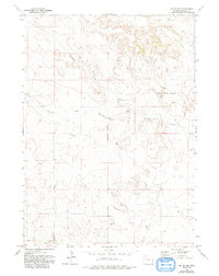
1974 Map of Jay Em NW
USGS Topo · Published 1993About this map
Red Cloud Cem stands as a primary landmark in this rural Goshen County landscape, recorded during the mid-1970s. The terrain is defined by the drainage patterns of Muskrat Creek, Cottonwood Creek, and Rawhide Creek, which cut through the high plains. Human infrastructure is concentrated along the historic Fort Laramie Road, reflecting the region's connection to early western transit corridors.
Find a feature on this map
9 named features on this map. Tap any name to fly to it.
Don’t see what you’re looking for? This feature index may not catch every label — zoom into the map to look around manually.
Map Details
Editions of this 1974 Jay Em NW Map
2 editions found
Other maps of this area

1896 · Patrick
USGS Topo · 1:125,000

1896 · Hartville
USGS Topo · 1:125,000

1901 · Hartville
USGS Topo · 1:125,000

1950 · Casebier Hill
USGS Topo · 1:24,000

1951 · Moore Spring
USGS Topo · 1:24,000

1954 · Torrington
USGS Topo · 1:250,000

1958 · Torrington
USGS Topo · 1:250,000
1974 · Jay Em NW
USGS Topo · 1:24,000

1974 · Jay Em
USGS Topo · 1:24,000

1974 · Rawhide Buttes East
USGS Topo · 1:24,000