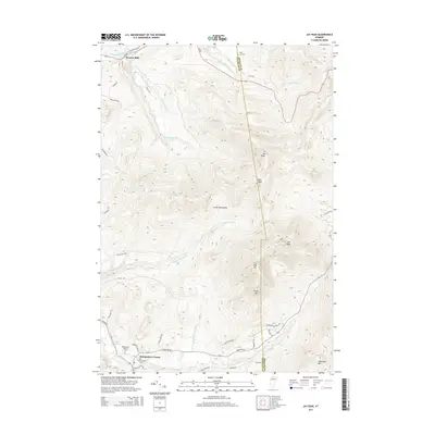
2015 Map of Jay Peak
USGS Topo · Published 2015About this map
Montgomery Center sits at the junction of several mountain roads in the southern reach of this Franklin County survey, serving as a hub for the high elevations of the Green Mountains. The landscape is dominated by the massive crest of Jay Peak, along with N Jay Peak, Doll Peak, Big Jay, and Little Jay. To the northwest, the settlement of Stevens Mills borders the Missisquoi River, while several cemeteries including Saint Isidore Cem, Montgomery Center Cem, and West Jay Cem provide clear reference points for genealogists researching families from the northern Vermont borderlands. The intricate drainage network of Hannah Clark Brook and Black Falls Brook illustrates the steep descent from the peaks toward the Trout River valley.
Find a feature on this map
51 named features on this map. Tap any name to fly to it.
Don’t see what you’re looking for? This feature index may not catch every label — zoom into the map to look around manually.
Map Details
Editions of this 2015 Jay Peak Map
This is the sole edition of this map. No revisions or reprints were ever made.
Other maps of this area

1919 · Montgomery
USGS Topo · 1:62,500

1920 · Montgomery
USGS Topo · 1:62,500

1920 · Irasburg
USGS Topo · 1:62,500

1923 · Irasburg
USGS Topo · 1:48,000

1925 · Irasburg
USGS Topo · 1:62,500

1925 · Jay Peak
USGS Topo · 1:62,500

1943 · Jay Peak
USGS Topo · 1:62,500

1950 · Lake Champlain
USGS Topo · 1:250,000

1953 · Jay Peak
USGS Topo · 1:62,500

1953 · Irasburg
USGS Topo · 1:62,500