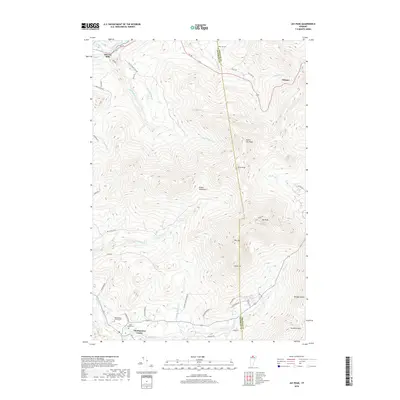
2018 Map of Jay Peak
USGS Topo · Published 2018About this map
The northern Green Mountains define this landscape, dominated by the prominent summits of Jay Peak and Big Jay. To the west, the village of Montgomery Center sits at the confluence of the Trout River and Hannah Clark Brook, serving as a gateway to the high ridgelines that separate Franklin Co from Orleans Co. This area demonstrates the intersection of Vermont's alpine terrain and its historic valley settlements. High mountain roads like Access Rd and Work Rd trace the steep eastern slopes, while the lowlands near Stevens Mills follow the Missisquoi River. Local genealogy is anchored by the Saint Isidore Cem and Montgomery Center Cem in the valley, and the West Jay Cem to the northeast, documenting the families who settled this challenging borderland geography.
Find a feature on this map
49 named features on this map. Tap any name to fly to it.
Don’t see what you’re looking for? This feature index may not catch every label — zoom into the map to look around manually.
Map Details
Editions of this 2018 Jay Peak Map
This is the sole edition of this map. No revisions or reprints were ever made.
Other maps of this area

1919 · Montgomery
USGS Topo · 1:62,500

1920 · Montgomery
USGS Topo · 1:62,500

1920 · Irasburg
USGS Topo · 1:62,500

1923 · Irasburg
USGS Topo · 1:48,000

1925 · Irasburg
USGS Topo · 1:62,500

1925 · Jay Peak
USGS Topo · 1:62,500

1943 · Jay Peak
USGS Topo · 1:62,500

1950 · Lake Champlain
USGS Topo · 1:250,000

1953 · Jay Peak
USGS Topo · 1:62,500

1953 · Irasburg
USGS Topo · 1:62,500