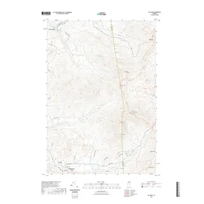
2021 Map of Jay Peak
USGS Topo · Published 2021About this map
Montgomery Center serves as the primary hub in the southwestern corner of this survey, situated where the Trout River and Jay Brook meet. The landscape is dominated by the steep elevations of the Green Mountains, featuring a prominent north-south ridge line that includes Jay Peak, Big Jay, and Little Jay. This high-altitude spine marks the border between Franklin and Orleans Counties, with drainage systems like Black Falls Brook and Stanhope Brook carving deep valleys into the western slopes.
Find a feature on this map
51 named features on this map. Tap any name to fly to it.
Don’t see what you’re looking for? This feature index may not catch every label — zoom into the map to look around manually.
Map Details
Editions of this 2021 Jay Peak Map
This is the sole edition of this map. No revisions or reprints were ever made.
Other maps of this area

1919 · Montgomery
USGS Topo · 1:62,500

1920 · Montgomery
USGS Topo · 1:62,500

1920 · Irasburg
USGS Topo · 1:62,500

1923 · Irasburg
USGS Topo · 1:48,000

1925 · Irasburg
USGS Topo · 1:62,500

1925 · Jay Peak
USGS Topo · 1:62,500

1943 · Jay Peak
USGS Topo · 1:62,500

1950 · Lake Champlain
USGS Topo · 1:250,000

1953 · Jay Peak
USGS Topo · 1:62,500

1953 · Irasburg
USGS Topo · 1:62,500