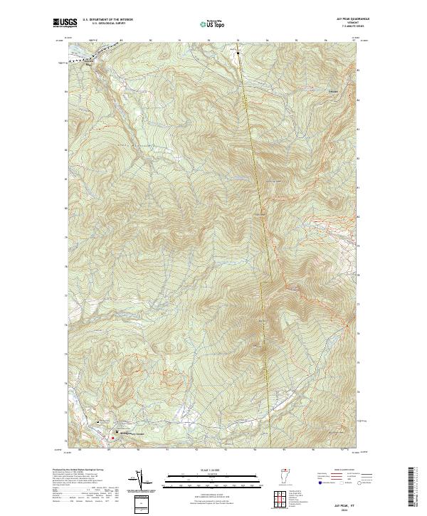
2024 Map of Jay Peak
USGS Topo · Published 2024About this map
The Green Mountains dominate this borderland landscape, defined by high peaks and the intricate drainage networks of the Missisquoi River and Trout River. The boundary between Franklin Co and Orleans Co runs along the high ridgeline, passing through significant summits such as Big Jay, Little Jay, and North Jay Peak. This terrain is navigated by iconic footpaths like The Long Trl and various backcountry routes, including the Big Jay Backcountry Access Trl.
Find a feature on this map
63 named features on this map. Tap any name to fly to it.
Don’t see what you’re looking for? This feature index may not catch every label — zoom into the map to look around manually.
Map Details
Editions of this 2024 Jay Peak Map
This is the sole edition of this map. No revisions or reprints were ever made.
Other maps of this area

1919 · Montgomery
USGS Topo · 1:62,500

1920 · Montgomery
USGS Topo · 1:62,500

1920 · Irasburg
USGS Topo · 1:62,500

1923 · Irasburg
USGS Topo · 1:48,000

1925 · Irasburg
USGS Topo · 1:62,500

1925 · Jay Peak
USGS Topo · 1:62,500

1943 · Jay Peak
USGS Topo · 1:62,500

1950 · Lake Champlain
USGS Topo · 1:250,000

1953 · Jay Peak
USGS Topo · 1:62,500

1953 · Irasburg
USGS Topo · 1:62,500