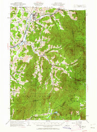
1953 Map of Jay Peak
USGS Topo · Published 1962About this map
The Missisquoi River valley and the high summits of the Green Mountains dominate this mid-century portrait of northern Vermont. In Richford, the intersection of the Canadian Pacific and Central Vermont railroads highlights the town's role as a border-crossing hub, complete with a U S Customs station. The landscape transitions from the river flats to the high peaks of Jay Peak and Belvidere Mtn, where an Asbestos Mine and a Lookout Tower mark human industry and observation in the high country. Small rural settlements like Hectorville, Hutchins, and Samsonville are connected by winding roads through the Cold Hollow Mountains, while local education is anchored at sites like Cooks School. The presence of the Long Trail and Hazens Notch State Forest Park underscores the region's long-standing recreational and timber value.
Find a feature on this map
87 named features on this map. Tap any name to fly to it.
Don’t see what you’re looking for? This feature index may not catch every label — zoom into the map to look around manually.
Map Details
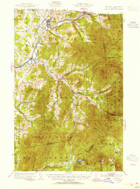
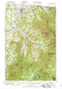
Editions of this 1953 Jay Peak Map
4 editions found

Other maps of this area

1919 · Montgomery
USGS Topo · 1:62,500

1920 · Franklin Pond
USGS Topo · 1:62,500

1920 · Montgomery
USGS Topo · 1:62,500

1920 · Irasburg
USGS Topo · 1:62,500

1922 · Enosburg Falls
USGS Topo · 1:48,000

1923 · Irasburg
USGS Topo · 1:48,000

1924 · Enosburg Falls
USGS Topo · 1:62,500

1925 · Irasburg
USGS Topo · 1:62,500

1925 · Jay Peak
USGS Topo · 1:62,500

1925 · Mount Mansfield
USGS Topo · 1:48,000