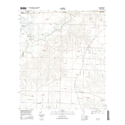
2015 Map of Jay
USGS Topo · Published 2015About this map
Big Escambia Creek and the Escambia River define the winding borderland between Florida and Alabama, carving a complex system of oxbows and secondary channels. This riverine landscape is marked by features such as Government Dead Lake, Ashton Dead River, and Turtle Cove Lake, illustrating a terrain shaped by shifting watercourses. The town of Jay serves as a primary hub on the Florida side, while smaller settlements like Brownsdale, Cobbtown, and Happy Valley are scattered across the surrounding agricultural and timber lands.
Find a feature on this map
124 named features on this map. Tap any name to fly to it.
Don’t see what you’re looking for? This feature index may not catch every label — zoom into the map to look around manually.
Map Details
Editions of this 2015 Jay Map
This is the sole edition of this map. No revisions or reprints were ever made.
Other maps of this area

1941 · Century
USGS Topo · 1:62,500

1943 · Century
USGS Topo · 1:62,500

1943 · Jay
USGS Topo · 1:62,500

1953 · Andalusia
USGS Topo · 1:250,000

1957 · Andalusia
USGS Topo · 1:250,000

1957 · Pensacola
USGS Topo · 1:250,000

1959 · Pensacola
USGS Topo · 1:250,000

1959 · Brewton South
USGS Topo · 1:24,000

1960 · Pensacola
USGS Topo · 1:250,000

1960 · Brewton South
USGS Topo · 1:24,000