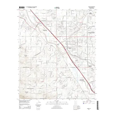
2014 Map of Jaynes
USGS Topo · Published 2014About this map
Saguaro National Park dominates the western landscape of this Pima County study, where the rugged Tucson Mountains rise sharply above the desert floor. The area serves as a critical junction for regional hydrology and transportation, centered on the confluence near Jaynes where the Cañada del Oro and the Rillito River meet the Santa Cruz River. This riparian corridor is paralleled by the historic path of the Union Pacific Railroad, which links the northwestern settlements of Cortaro and Marana to the expanding northern reaches of Tucson.
Find a feature on this map
44 named features on this map. Tap any name to fly to it.
Don’t see what you’re looking for? This feature index may not catch every label — zoom into the map to look around manually.
Map Details
Editions of this 2014 Jaynes Map
This is the sole edition of this map. No revisions or reprints were ever made.
Other maps of this area

1904 · Tucson
USGS Topo · 1:125,000

1905 · Tucson
USGS Topo · 1:125,000

1925 · San Xavier
USGS Topo · 1:62,500

1934 · Tucson Mountains
USGS Topo · 1:125,000

1943 · San Xavier Mission
USGS Topo · 1:62,500

1947 · Cortaro
USGS Topo · 1:62,500

1948 · Tucson
USGS Topo · 1:62,500

1956 · Tucson
USGS Topo · 1:250,000

1957 · San Xavier Mission
USGS Topo · 1:62,500

1957 · Tucson
USGS Topo · 1:24,000