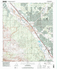
1996 Map of Jaynes
USGS Topo · Published 2002About this map
The Santa Cruz River valley northwest of Tucson shows a landscape of suburban expansion and industrial utility in the late 1990s. The Southern Pacific railroad corridor serves as the primary spine for settlements like Cortaro, Jaynes, and Stockham, which are surrounded by a growing network of roads such as Pima Farm Road and Ruthrauff Road. The transition from the desert floor to the heights is marked by the boundaries of Saguaro National Park and Tucson Mountain Park to the west, where the Gila Monster Mine and other unnamed mines signify the area's extraction history.
Find a feature on this map
45 named features on this map. Tap any name to fly to it.
Don’t see what you’re looking for? This feature index may not catch every label — zoom into the map to look around manually.
Map Details
Editions of this 1996 Jaynes Map
This is the sole edition of this map. No revisions or reprints were ever made.
Other maps of this area

1904 · Tucson
USGS Topo · 1:125,000

1905 · Tucson
USGS Topo · 1:125,000

1925 · San Xavier
USGS Topo · 1:62,500

1934 · Tucson Mountains
USGS Topo · 1:125,000

1943 · San Xavier Mission
USGS Topo · 1:62,500

1947 · Cortaro
USGS Topo · 1:62,500

1948 · Tucson
USGS Topo · 1:62,500

1956 · Tucson
USGS Topo · 1:250,000

1957 · San Xavier Mission
USGS Topo · 1:62,500

1957 · Tucson
USGS Topo · 1:24,000