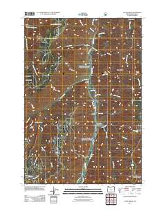
2011 Map of Jaynes Ridge
USGS Topo · Published 2011About this map
The Imnaha River carves a deep path through Wallowa County, serving as the central artery for this remote portion of northeastern Oregon. The drainage system is defined by steep canyons and ridges, including the prominent Jaynes Ridge and Morgan Ridge. Along the river’s course, human presence is marked by essential rural landmarks such as the Imnaha Grange and the Park Cemetery, indicating the enduring agricultural and social ties of the local community.
Find a feature on this map
39 named features on this map. Tap any name to fly to it.
Don’t see what you’re looking for? This feature index may not catch every label — zoom into the map to look around manually.
Map Details
Editions of this 2011 Jaynes Ridge Map
This is the sole edition of this map. No revisions or reprints were ever made.
Other maps of this area

1920 · Seven Devils Mining District
USGS Topo · 1:48,000

1922 · He Devil
USGS Topo · 1:48,000

1954 · Harl Butte
USGS Topo · 1:62,500

1955 · Grangeville
USGS Topo · 1:250,000

1957 · He Devil
USGS Topo · 1:62,500

1957 · Cuprum
USGS Topo · 1:62,500

1957 · Homestead
USGS Topo · 1:62,500

1959 · Grangeville
USGS Topo · 1:250,000

1987 · Riggins
USGS Topo · 1:100,000
1990 · Puderbaugh Ridge
USGS Topo · 1:24,000