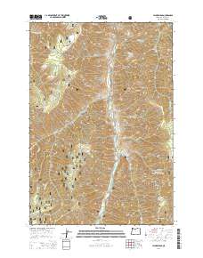
2014 Map of Jaynes Ridge
USGS Topo · Published 2014About this map
The Imnaha River carves a deep path through this section of the Wallowa National Forest, where high ridgelines and steep drainages define the landscape. This 2014 survey documents a territory of immense vertical relief, from the heights of Jaynes Ridge and Summit Ridge down to the water-carved depths of Neil Canyon and Road Canyon. Human presence is sparse, marked primarily by Forest Service routes such as Nat For Dev Rd 3930 and the remote Park Cem situated near Grouse Cr.
Find a feature on this map
48 named features on this map. Tap any name to fly to it.
Don’t see what you’re looking for? This feature index may not catch every label — zoom into the map to look around manually.
Map Details
Editions of this 2014 Jaynes Ridge Map
This is the sole edition of this map. No revisions or reprints were ever made.
Other maps of this area

1920 · Seven Devils Mining District
USGS Topo · 1:48,000

1922 · He Devil
USGS Topo · 1:48,000

1954 · Harl Butte
USGS Topo · 1:62,500

1955 · Grangeville
USGS Topo · 1:250,000

1957 · He Devil
USGS Topo · 1:62,500

1957 · Cuprum
USGS Topo · 1:62,500

1957 · Homestead
USGS Topo · 1:62,500

1959 · Grangeville
USGS Topo · 1:250,000

1987 · Riggins
USGS Topo · 1:100,000
1990 · Puderbaugh Ridge
USGS Topo · 1:24,000