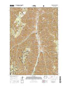
2017 Map of Jaynes Ridge
USGS Topo · Published 2017About this map
The Imnaha River carves a deep path through this section of the Wallowa National Forest, defining a landscape of high, parallel ridges and steep drainages. Significant elevation changes are marked by Jaynes Ridge, Beeler Ridge, and Summit Ridge, which overlook a network of seasonal and perennial waters like Winston Cr and Johnson Cr. The small Park Cem sits along Upper Imnaha Rd, serving as a localized historical marker in an area otherwise dominated by the natural features of the national forest.
Find a feature on this map
44 named features on this map. Tap any name to fly to it.
Don’t see what you’re looking for? This feature index may not catch every label — zoom into the map to look around manually.
Map Details
Editions of this 2017 Jaynes Ridge Map
This is the sole edition of this map. No revisions or reprints were ever made.
Other maps of this area

1920 · Seven Devils Mining District
USGS Topo · 1:48,000

1922 · He Devil
USGS Topo · 1:48,000

1954 · Harl Butte
USGS Topo · 1:62,500

1955 · Grangeville
USGS Topo · 1:250,000

1957 · He Devil
USGS Topo · 1:62,500

1957 · Cuprum
USGS Topo · 1:62,500

1957 · Homestead
USGS Topo · 1:62,500

1959 · Grangeville
USGS Topo · 1:250,000

1987 · Riggins
USGS Topo · 1:100,000
1990 · Puderbaugh Ridge
USGS Topo · 1:24,000