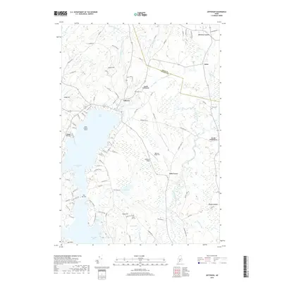
2018 Map of Jefferson
USGS Topo · Published 2018About this map
Jefferson sits at the northern reach of Damariscotta Lake, where Davis Stream flows into the Great Bay. This Lincoln County landscape is defined by its dense network of small settlements and family-named terrain, including Haskell Hill and Eugley Hill. The map detail traces the rural character of central Maine, showing the distribution of local burial grounds like Fairview Cem and Forest Lake Cem alongside recreational landmarks such as Camp Wavus on the lake's eastern shore. To the east, the Medomak River winds through a corridor of interconnected hamlets including Orffs Corner, North Waldoboro, and Davis Corner. The presence of several legacy clearings, such as Robinson Ridge Field, highlights the historical agricultural patterns that have shaped this region of Maine since the early nineteenth century.
Find a feature on this map
100 named features on this map. Tap any name to fly to it.
Don’t see what you’re looking for? This feature index may not catch every label — zoom into the map to look around manually.
Map Details
Editions of this 2018 Jefferson Map
This is the sole edition of this map. No revisions or reprints were ever made.
Other maps of this area

1893 · Vassalboro
USGS Topo · 1:62,500

1893 · Wiscasset
USGS Topo · 1:62,500

1898 · Vassalboro
USGS Topo · 1:62,500

1913 · Waldoboro
USGS Topo · 1:48,000

1915 · Waldoboro
USGS Topo · 1:62,500

1916 · Liberty
USGS Topo · 1:62,500

1941 · Waldoboro
USGS Topo · 1:62,500

1941 · Vassalboro
USGS Topo · 1:62,500

1942 · Liberty
USGS Topo · 1:62,500

1943 · Vassalboro
USGS Topo · 1:62,500