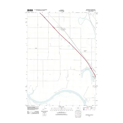
2011 Map of Jefferson
USGS Topo · Published 2011About this map
Jefferson sits at the heart of this survey, positioned where the fertile plains of Union Co meet the winding corridors of the Missouri River and the Big Sioux River. The landscape is defined by its riparian geometry, with the oxbow of McCook Lake serving as a prominent landmark south of the main settlement. This area represents a critical tri-state junction where South Dakota, Nebraska, and Iowa converge, a fact reflected in the diverse road network including Co Rd 18 and Main St that connect these agricultural and residential hubs.
Find a feature on this map
35 named features on this map. Tap any name to fly to it.
Don’t see what you’re looking for? This feature index may not catch every label — zoom into the map to look around manually.
Map Details
Editions of this 2011 Jefferson Map
This is the sole edition of this map. No revisions or reprints were ever made.
Other maps of this area

1898 · Elk Point
USGS Topo · 1:125,000

1901 · Elk Point
USGS Topo · 1:125,000

1907 · Elk Point
USGS Topo · 1:125,000

1955 · Sioux City
USGS Topo · 1:250,000

1958 · Sioux City
USGS Topo · 1:250,000

1959 · Sioux City
USGS Topo · 1:250,000

1963 · Elk Point
USGS Topo · 1:24,000

1963 · Sioux City South
USGS Topo · 1:24,000

1963 · Sioux City North
USGS Topo · 1:24,000

1963 · Elk Point NE
USGS Topo · 1:24,000