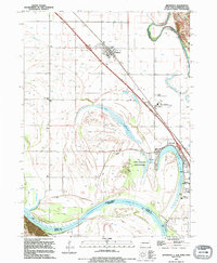
1994 Map of Jefferson
USGS Topo · Published 1995About this map
The Missouri River forms a dynamic boundary in this tri-state borderland, where South Dakota, Nebraska, and Iowa converge. The landscape is defined by the sharp meanders of the river and the remnant oxbows that have created distinctive water bodies like Goodenough Lake and Mc Cook Lake. The settlement of Jefferson serves as a local hub along the Chicago and North Western railroad line, while the nearby Jefferson International Speedway and Jefferson Speedway reflect the area's recreational development by the early 1990s.
Find a feature on this map
29 named features on this map. Tap any name to fly to it.
Don’t see what you’re looking for? This feature index may not catch every label — zoom into the map to look around manually.
Map Details
Editions of this 1994 Jefferson Map
This is the sole edition of this map. No revisions or reprints were ever made.
Other maps of this area

1898 · Elk Point
USGS Topo · 1:125,000

1901 · Elk Point
USGS Topo · 1:125,000

1907 · Elk Point
USGS Topo · 1:125,000

1955 · Sioux City
USGS Topo · 1:250,000

1958 · Sioux City
USGS Topo · 1:250,000

1959 · Sioux City
USGS Topo · 1:250,000

1963 · Elk Point
USGS Topo · 1:24,000

1963 · Sioux City South
USGS Topo · 1:24,000

1963 · Sioux City North
USGS Topo · 1:24,000

1963 · Elk Point NE
USGS Topo · 1:24,000
Featured Places
- Dakota Dunes, SD
- North Sioux City, SD
- Jefferson, SD
- St. Johns Precinct, NE
- McCook Lake, North Sioux City