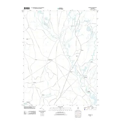
2011 Map of Jenkins
USGS Topo · Published 2011About this map
Harrisville and the Wading River basin define this Pine Barrens landscape, where numerous small settlements and water-powered sites are connected by an intricate network of local sand roads. The West Branch Wading River flows through the center of the area, feeding into Harrisville Pond and passing the Harrisville Dam. To the east, the Oswego River and Martha Pond indicate the industrial footprint of the former Martha furnace site. The road network, including the Tuckerton Rd and Old Wading River Maxwell Rd, links dispersed points like Stormy Hill, Jenkins, and Bulltown. Local history is preserved in names like Charcoal Landing and Crowleytown, which reflect the early river-based economy and cedar swamp industries that once thrived in Washington township.
Find a feature on this map
80 named features on this map. Tap any name to fly to it.
Don’t see what you’re looking for? This feature index may not catch every label — zoom into the map to look around manually.
Map Details
Editions of this 2011 Jenkins Map
This is the sole edition of this map. No revisions or reprints were ever made.
Other maps of this area

1884 · Whitings
USGS Topo · 1:62,500

1888 · Pemberton
USGS Topo · 1:62,500

1888 · Little Egg Harbor
USGS Topo · 1:62,500

1888 · Whitings
USGS Topo · 1:62,500

1890 · Mullica
USGS Topo · 1:62,500

1893 · Little Egg Harbor
USGS Topo · 1:62,500

1894 · Pemberton
USGS Topo · 1:62,500

1894 · Mullica
USGS Topo · 1:62,500

1898 · Pemberton
USGS Topo · 1:62,500

1898 · Mullica
USGS Topo · 1:62,500
Featured Places
- Tabernacle Township, NJ
- Mullica Township, NJ
- Bass River Township, NJ
- Washington Township, NJ
- Crowleytown, Washington Township