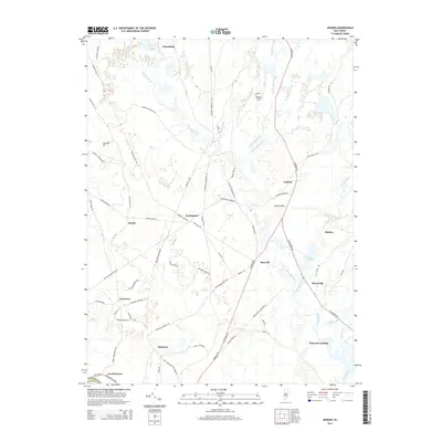
2014 Map of Jenkins
USGS Topo · Published 2014About this map
The W Br Wading River and the Oswego River converge in this corner of the New Jersey Pine Barrens, defining a landscape of wetlands and isolated settlements. Small hamlets like Jenkins and Harrisville are connected by a network of historic thoroughfares, including the Carranza Rd and Tuckerton Rd, which cross through dense lowlands and along the edges of the Hawkins Lowland. The map reveals the area's industrial and agricultural past through names like Charcoal Landing and Tylertown, alongside geographic features like Jemima Mt. Water remains the dominant feature, with Harrisville Pond and Martha Pond standing as significant landmarks in a region defined by its numerous brooks and runs, including Hospitality Brook and Little Hauken Run.
Find a feature on this map
78 named features on this map. Tap any name to fly to it.
Don’t see what you’re looking for? This feature index may not catch every label — zoom into the map to look around manually.
Map Details
Editions of this 2014 Jenkins Map
This is the sole edition of this map. No revisions or reprints were ever made.
Other maps of this area

1884 · Whitings
USGS Topo · 1:62,500

1888 · Pemberton
USGS Topo · 1:62,500

1888 · Little Egg Harbor
USGS Topo · 1:62,500

1888 · Whitings
USGS Topo · 1:62,500

1890 · Mullica
USGS Topo · 1:62,500

1893 · Little Egg Harbor
USGS Topo · 1:62,500

1894 · Pemberton
USGS Topo · 1:62,500

1894 · Mullica
USGS Topo · 1:62,500

1898 · Pemberton
USGS Topo · 1:62,500

1898 · Mullica
USGS Topo · 1:62,500
Featured Places
- Tabernacle Township, NJ
- Mullica Township, NJ
- Bass River Township, NJ
- Washington Township, NJ
- Crowleytown, Washington Township