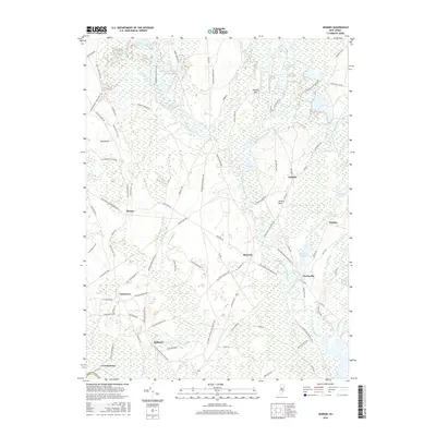
2016 Map of Jenkins
USGS Topo · Published 2016About this map
Tulpehocken Creek and the West Branch Wading River define this corner of the New Jersey Pine Barrens, where water management is central to the landscape. In the northern reaches, the Friendship Cranberry Bogs and Hog Wallow Cranberry Bogs reveal the specialized agriculture of the region. This 2016 survey documents small, isolated settlements like Jenkins, Maxwell, and Harrisville, many of which developed around the early iron and glass industries or cranberry production. The map details an intricate network of specialized roads, such as the Jemima Feedstrip Rd and Piney Pond Feedstrip, alongside traditional routes like the Washington Tpke. From the elevations of Jemima Mt to the low-lying Benn Swamp, the terrain is a complex mix of sandy ridges and cedar-water drainage, including features like Harrisville Pond and Martha Pond.
Find a feature on this map
94 named features on this map. Tap any name to fly to it.
Don’t see what you’re looking for? This feature index may not catch every label — zoom into the map to look around manually.
Map Details
Editions of this 2016 Jenkins Map
This is the sole edition of this map. No revisions or reprints were ever made.
Other maps of this area

1884 · Whitings
USGS Topo · 1:62,500

1888 · Pemberton
USGS Topo · 1:62,500

1888 · Little Egg Harbor
USGS Topo · 1:62,500

1888 · Whitings
USGS Topo · 1:62,500

1890 · Mullica
USGS Topo · 1:62,500

1893 · Little Egg Harbor
USGS Topo · 1:62,500

1894 · Pemberton
USGS Topo · 1:62,500

1894 · Mullica
USGS Topo · 1:62,500

1898 · Pemberton
USGS Topo · 1:62,500

1898 · Mullica
USGS Topo · 1:62,500
Featured Places
- Tabernacle Township, NJ
- Mullica Township, NJ
- Bass River Township, NJ
- Washington Township, NJ
- Crowleytown, Washington Township