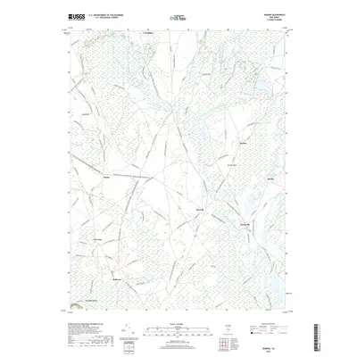
2019 Map of Jenkins
USGS Topo · Published 2019About this map
Friendship Cranberry Bogs and Hog Wallow Cranberry Bogs dominate this portion of the New Jersey Pine Barrens, illustrating the enduring agricultural legacy of the region. The landscape is defined by the intricate hydrology of the West Branch Wading River and Oswego River, which supported early industrial outposts like Harrisville and Martha. The map details a network of historic thoroughfares and trails, including Tuckerton Rd and Washington Tpke, which once connected these isolated settlements. Minor elevations such as Jemima Mt and Stormy Hill rise above the wetlands, providing distinct landmarks in an otherwise low-lying terrain. From the northern reaches near Friendship to the southern boundary at Crowleytown, the map reveals a pattern of dispersed hamlets like Bulltown and Tylertown linked by sand roads and cycling trails, reflecting the area's transition from 19th-century industry to modern conservation.
Find a feature on this map
104 named features on this map. Tap any name to fly to it.
Don’t see what you’re looking for? This feature index may not catch every label — zoom into the map to look around manually.
Map Details
Editions of this 2019 Jenkins Map
This is the sole edition of this map. No revisions or reprints were ever made.
Other maps of this area

1884 · Whitings
USGS Topo · 1:62,500

1888 · Pemberton
USGS Topo · 1:62,500

1888 · Little Egg Harbor
USGS Topo · 1:62,500

1888 · Whitings
USGS Topo · 1:62,500

1890 · Mullica
USGS Topo · 1:62,500

1893 · Little Egg Harbor
USGS Topo · 1:62,500

1894 · Pemberton
USGS Topo · 1:62,500

1894 · Mullica
USGS Topo · 1:62,500

1898 · Pemberton
USGS Topo · 1:62,500

1898 · Mullica
USGS Topo · 1:62,500
Featured Places
- Tabernacle Township, NJ
- Mullica Township, NJ
- Bass River Township, NJ
- Washington Township, NJ
- Crowleytown, Washington Township