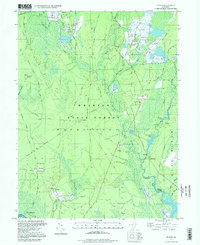
1997 Map of Jenkins
USGS Topo · Published 1998About this map
Wharton State Forest dominates this Pine Barrens landscape, where the legacy of early industrial activity and agriculture is etched into the terrain. The presence of the Washington Ruin and the Charcoal Landing along the Wading River points to the region's historic reliance on timber and bog iron. Extensive Cranberry Bogs, including the notably named Hog Wallow Cranberry Bogs, indicate the specialized wetland farming that has defined this area for generations.
Find a feature on this map
57 named features on this map. Tap any name to fly to it.
Don’t see what you’re looking for? This feature index may not catch every label — zoom into the map to look around manually.
Map Details
Editions of this 1997 Jenkins Map
This is the sole edition of this map. No revisions or reprints were ever made.
Other maps of this area

1884 · Whitings
USGS Topo · 1:62,500

1888 · Pemberton
USGS Topo · 1:62,500

1888 · Little Egg Harbor
USGS Topo · 1:62,500

1888 · Whitings
USGS Topo · 1:62,500

1890 · Mullica
USGS Topo · 1:62,500

1893 · Little Egg Harbor
USGS Topo · 1:62,500

1894 · Pemberton
USGS Topo · 1:62,500

1894 · Mullica
USGS Topo · 1:62,500

1898 · Pemberton
USGS Topo · 1:62,500

1898 · Mullica
USGS Topo · 1:62,500
Featured Places
- Tabernacle Township, NJ
- Mullica Township, NJ
- Bass River Township, NJ
- Washington Township, NJ
- Crowleytown, Washington Township