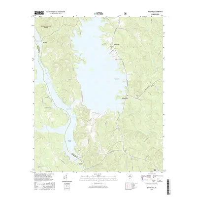
2017 Map of Jenkinsville
USGS Topo · Published 2017About this map
The Broad River and its accompanying reservoirs dominate this Fairfield County landscape, creating a complex network of inlets and islands. Pearsons Island and Hampton Island sit at the confluence of river and reservoir, while the large expanse of the Monticello Reservoir stretches north toward the settlement of Monticello. The map reflects a deeply rooted community, evidenced by numerous burial grounds including Monticello Cem, Friendship Cem, and Little River Cem.
Find a feature on this map
62 named features on this map. Tap any name to fly to it.
Don’t see what you’re looking for? This feature index may not catch every label — zoom into the map to look around manually.
Map Details
Editions of this 2017 Jenkinsville Map
This is the sole edition of this map. No revisions or reprints were ever made.
Other maps of this area

1904 · Columbia
USGS Topo · 1:125,000

1941 · Spartanburg
USGS Topo · 1:250,000

1947 · Richtex
USGS Topo · 1:24,000

1949 · Richtex
USGS Topo · 1:24,000

1953 · Spartanburg
USGS Topo · 1:250,000

1960 · Spartanburg
USGS Topo · 1:250,000

1963 · Spartanburg
USGS Topo · 1:250,000

1964 · Spartanburg
USGS Topo · 1:250,000

1969 · Lebanon
USGS Topo · 1:24,000

1969 · Pomaria
USGS Topo · 1:24,000