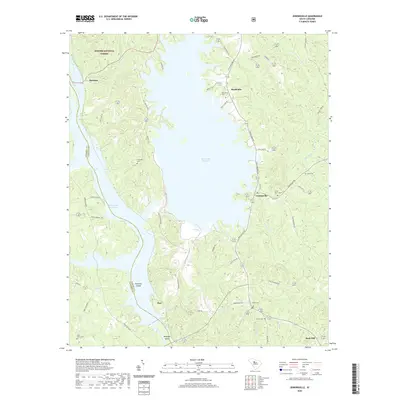
2020 Map of Jenkinsville
USGS Topo · Published 2020About this map
The Broad River and its accompanying reservoirs dominate the landscape of Fairfield and Newberry counties in this modern topographic study. The massive Monticello Reservoir creates a complex, jagged shoreline in the center of the sheet, while the Parr Shoals Reservoir occupies the river channel to the southwest. This hydroelectric landscape is defined by its infrastructure, including Tailrace Rd and S Lake Access Rd, which service the water-driven energy production at Parr.
Find a feature on this map
57 named features on this map. Tap any name to fly to it.
Don’t see what you’re looking for? This feature index may not catch every label — zoom into the map to look around manually.
Map Details
Editions of this 2020 Jenkinsville Map
This is the sole edition of this map. No revisions or reprints were ever made.
Other maps of this area

1904 · Columbia
USGS Topo · 1:125,000

1941 · Spartanburg
USGS Topo · 1:250,000

1947 · Richtex
USGS Topo · 1:24,000

1949 · Richtex
USGS Topo · 1:24,000

1953 · Spartanburg
USGS Topo · 1:250,000

1960 · Spartanburg
USGS Topo · 1:250,000

1963 · Spartanburg
USGS Topo · 1:250,000

1964 · Spartanburg
USGS Topo · 1:250,000

1969 · Lebanon
USGS Topo · 1:24,000

1969 · Pomaria
USGS Topo · 1:24,000