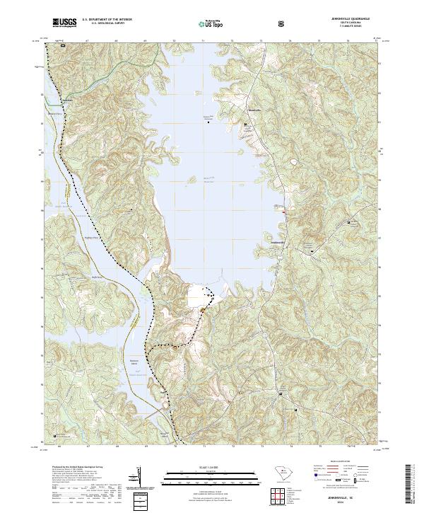
2024 Map of Jenkinsville
USGS Topo · Published 2024About this map
The Monticello Reservoir dominates the central landscape of this South Carolina quadrangle, acting as a massive geographical anchor between the rural settlements of Monticello and Jenkinsville. This contemporary survey highlights the region's complex water network, where the Broad River flows south into the Parr Shoals Reservoir, passing Pearsons Island and Hampton Island. The topography is defined by the sharp transition from the managed waters of the reservoir to the dense woodlands of the Sumter National Forest in the northwest.
Find a feature on this map
77 named features on this map. Tap any name to fly to it.
Don’t see what you’re looking for? This feature index may not catch every label — zoom into the map to look around manually.
Map Details
Editions of this 2024 Jenkinsville Map
This is the sole edition of this map. No revisions or reprints were ever made.
Other maps of this area

1904 · Columbia
USGS Topo · 1:125,000

1941 · Spartanburg
USGS Topo · 1:250,000

1947 · Richtex
USGS Topo · 1:24,000

1949 · Richtex
USGS Topo · 1:24,000

1953 · Spartanburg
USGS Topo · 1:250,000

1960 · Spartanburg
USGS Topo · 1:250,000

1963 · Spartanburg
USGS Topo · 1:250,000

1964 · Spartanburg
USGS Topo · 1:250,000

1969 · Lebanon
USGS Topo · 1:24,000

1969 · Pomaria
USGS Topo · 1:24,000