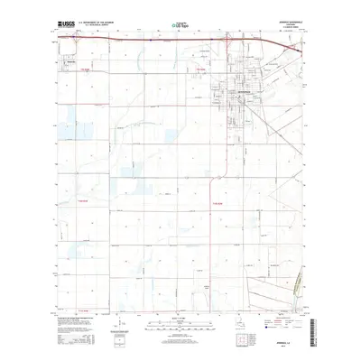
2015 Map of Jennings
USGS Topo · Published 2015About this map
The city of Jennings serves as the focal point of this Jefferson Davis Parish landscape, showing a dense residential grid punctuated by local history landmarks like Greenwood Cem and Calvary Cem. Situated in the heart of Louisiana's rice-growing country, the area is defined by an intricate network of water management features, including the Jennings Norwood Canal and Broadmore Ditch. These man-made channels work alongside natural drainage systems like West Bayou Grand Marais and Middle Bayou Grand Marais to manage the low-lying prairie terrain.
Find a feature on this map
120 named features on this map. Tap any name to fly to it.
Don’t see what you’re looking for? This feature index may not catch every label — zoom into the map to look around manually.
Map Details
Editions of this 2015 Jennings Map
This is the sole edition of this map. No revisions or reprints were ever made.
Other maps of this area

1946 · Lake Arthur
USGS Topo · 1:31,680

1946 · Mermentau
USGS Topo · 1:31,680

1946 · Jennings
USGS Topo · 1:31,680

1947 · Evangeline
USGS Topo · 1:31,680

1947 · Thornwell
USGS Topo · 1:31,680

1947 · Pine Island
USGS Topo · 1:31,680

1947 · Welsh
USGS Topo · 1:31,680

1947 · Hathaway
USGS Topo · 1:31,680

1949 · Gueydan
USGS Topo · 1:31,680

1952 · Lake Charles
USGS Topo · 1:250,000