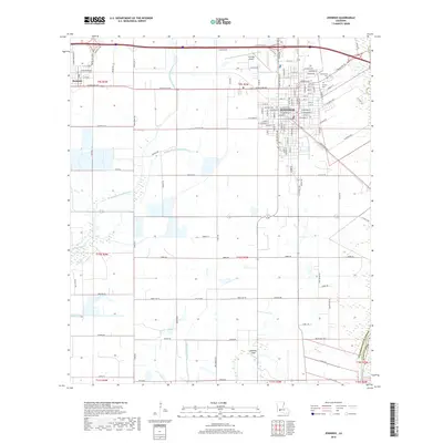
2018 Map of Jennings
USGS Topo · Published 2018About this map
The parish seat of Jennings serves as the focal point of this southwestern Louisiana landscape, where the urban grid meets an intricate network of agricultural drainage and natural waterways. To the west lies the community of Roanoke, situated along the southern edge of the Interstate corridor. The geography is defined by the slow-moving waters of West Bayou Grand Marais, Middle Bayou Grand Marais, and Bayou Chene, which weave through the low-lying prairie toward the Mermentau River at the southeastern edge of the survey area.
Find a feature on this map
127 named features on this map. Tap any name to fly to it.
Don’t see what you’re looking for? This feature index may not catch every label — zoom into the map to look around manually.
Map Details
Editions of this 2018 Jennings Map
This is the sole edition of this map. No revisions or reprints were ever made.
Other maps of this area

1946 · Lake Arthur
USGS Topo · 1:31,680

1946 · Mermentau
USGS Topo · 1:31,680

1946 · Jennings
USGS Topo · 1:31,680

1947 · Evangeline
USGS Topo · 1:31,680

1947 · Thornwell
USGS Topo · 1:31,680

1947 · Pine Island
USGS Topo · 1:31,680

1947 · Welsh
USGS Topo · 1:31,680

1947 · Hathaway
USGS Topo · 1:31,680

1949 · Gueydan
USGS Topo · 1:31,680

1952 · Lake Charles
USGS Topo · 1:250,000