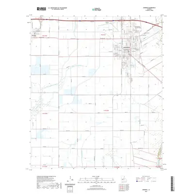
2020 Map of Jennings
USGS Topo · Published 2020About this map
The city of Jennings and the neighboring settlement of Roanoke anchor this 2020 landscape in southwestern Louisiana. The map captures a detailed street grid in the regional hub of Jennings, highlighting the central Jefferson Davis Parish Courthouse and the Sowela Technical Community College Morgan Smith Campus. Beyond the developed city center, the terrain is defined by a sophisticated system of water management and natural drainage, including the West Bayou Grand Marais, Middle Bayou Grand Marais, and the Jennings Norwood Canal. To the south and east, the Mermentau River marks the boundary near Acadia Parish. This modern survey illustrates the intersection of municipal growth and the agricultural landscape, where numerous family-named roads like Mouton Rd and Legros Rd crisscross a network of irrigation ditches and bayous.
Find a feature on this map
114 named features on this map. Tap any name to fly to it.
Don’t see what you’re looking for? This feature index may not catch every label — zoom into the map to look around manually.
Map Details
Editions of this 2020 Jennings Map
This is the sole edition of this map. No revisions or reprints were ever made.
Other maps of this area

1946 · Lake Arthur
USGS Topo · 1:31,680

1946 · Mermentau
USGS Topo · 1:31,680

1946 · Jennings
USGS Topo · 1:31,680

1947 · Evangeline
USGS Topo · 1:31,680

1947 · Thornwell
USGS Topo · 1:31,680

1947 · Pine Island
USGS Topo · 1:31,680

1947 · Welsh
USGS Topo · 1:31,680

1947 · Hathaway
USGS Topo · 1:31,680

1949 · Gueydan
USGS Topo · 1:31,680

1952 · Lake Charles
USGS Topo · 1:250,000